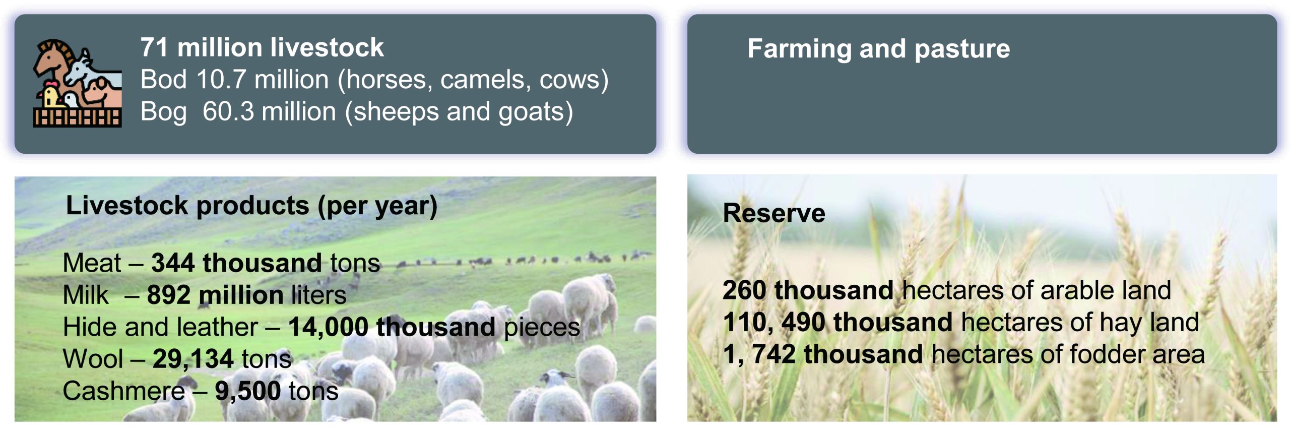
Geography and climate
Bordered on the north by Russia and on the east, south and west by China, Mongolia has a total area of one point five million square kilometers, making it the nineteenth largest country in the world and the second largest landlocked country. For administrative purposes, the territory is divided into three cities and twenty-one provinces (aimags). The most significant population center is the capital Ulaanbaatar, home to approximately 1.3 million people.
Mongolia is situated on a plateau far from any oceans, with average elevation of one and a half kilometers. 5 This gives it an extreme continental climate which varies considerably across the country and between the seasons. Broadly speaking, elevation is lowest in the east of the country, rising to the Altai mountain range in the west. Mongolia’s highest point is a mountain peak marking the western border between Mongolia, Russia and China. Travelling from north to south, one would go from Siberian forests and lakes, pass through open steppe grassland and mountains, and ultimately reach the Gobi desert.
The country has long cold winters and short warm summers. Winters are dry and summer rainfall rarely exceeds three hundred and eighty millimeters in the mountains and is less than fifty millimeters in the desert areas. 6 Temperatures in Ulaanbaatar can regularly exceed thirty degrees Celsius from mid-June to mid-August, but are also often below minus thirty degrees Celsius in winter. Spring and autumn are unpredictable and snow can be seen in early June or late August. However, spells of warm weather also occur at early as April and as late as October.